Your Name in Landsat
Transform your identity into a scientific masterpiece using 50 years of Earth-observing satellite data.
Type in your name to see it spelled out in Landsat imagery of Earth.
Current Location
Nusantara, Indonesia0°58'18.1 S 116°41'58.9 EAbout
The satellite images used in this interactive are part of Landsat's extensive record, spanning more than 50 years. Sources include NASA Earth Observatory, NASA Worldview, USGS EarthExplorer, and ESA Sentinel Hub.
Your Name in Landsat Image Gallery
72 images


APRIL 22, 2025
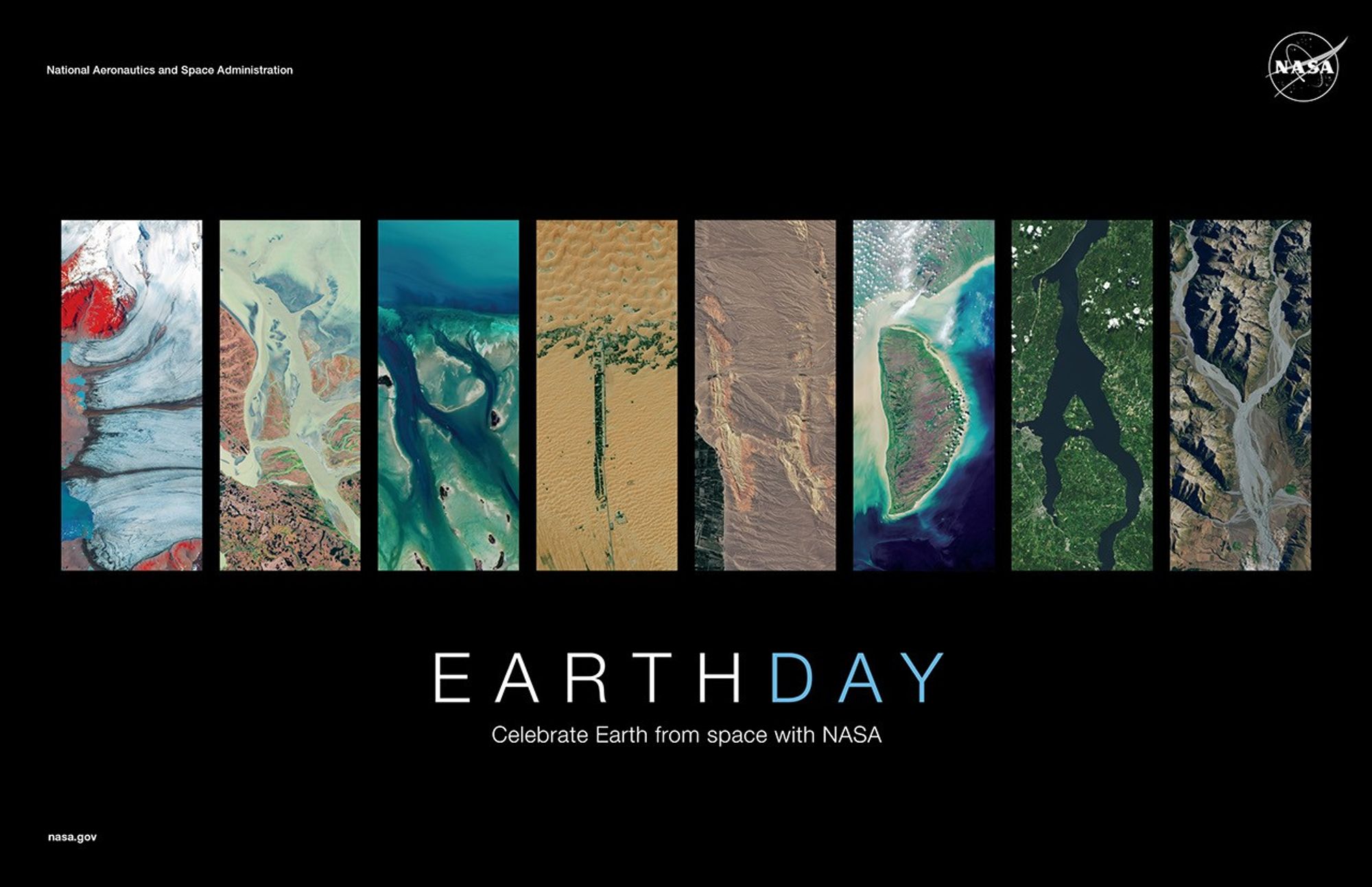
NASA Earth Day Poster 2025
This is year 2025's Earth Day poster and see your name in Landsat. Type in your name, then view and export the graphic in Earth features found in Landsat imagery.
Stories from Space

2026-05-06
Fractured Ice at Wolstenholme Fjord
In northwest Greenland, glacier outlets and ice flows intersect to form a crisp lowercase 'x' that reads like a deliberate mark from orbit.

2026-05-06
Where the Bíobío River Splits
The Bíobío River in Chile forks into a graceful lowercase 'y', showing how river branching can read like handwriting from space.

2026-05-06
Geometry in the Fields of Primavera do Leste
Agricultural geometry in Brazil's Mato Grosso state forms a sharp lowercase 'z' that looks cut into the landscape with straight edges.

2026-05-05
Winter Lines on the Mackenzie River
A frozen reach of Canada's Mackenzie River shows how ice, meanders, and permafrost combine to shape a readable Arctic river form.
Frequently Asked Questions
Everything you need to know about Landsat imagery, usage, sharing, and data provenance.
What is Your Name in Landsat?
It is an interactive experience that spells your name with real satellite scenes where Earth features resemble letterforms.
Are the Landsat images edited or recolored?
No. We keep original satellite image pixels intact. The tool only arranges selected letter images into your name.
Where do the letter images come from?
Image references are sourced from NASA Landsat outreach and related public Earth observation sources listed on each detail page.
Can I click coordinates and open the location on Google Maps?
Yes. In the generator section, each selected letter shows coordinates, and the coordinate line links directly to Google Maps.
Can I download and share my generated name image?
Yes. After entering a name, you can download the generated image and share it through a link or QR code.
Is this free to use?
Yes. The interactive and gallery browsing are free to use for educational and exploratory purposes.
Can I use generated images for commercial projects?
Usage rights depend on source data terms and your jurisdiction. Review source attribution and licensing notes before commercial use.
Why do some names look different in spacing or composition?
Each letter image has a unique aspect ratio and landform shape, so compositions vary by name length and selected letters.